




In Pictures: Designs to bring greener public space and better links to Anderston
 Reading time: 3 minutes
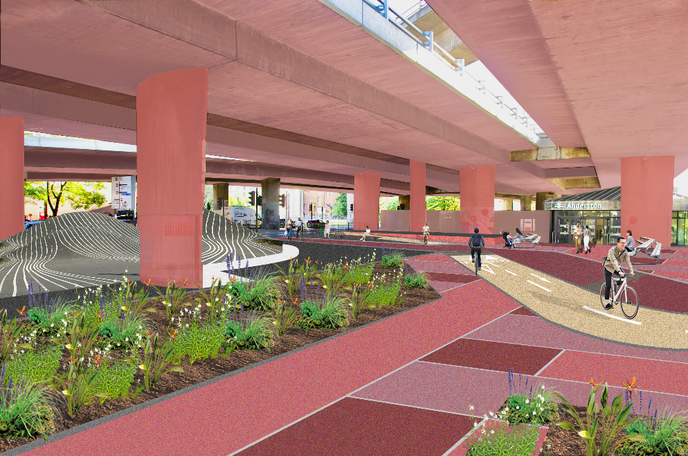
Public realm around Anderston Station
Proposals to transform the area around Anderston Station and improve connections between the city centre and West End are now open for public consultation.
Connecting Anderston would create a safer, greener gateway beneath the M8, with accessible walking and wheeling routes, while closing a key gap in Glasgow’s protected cycle network.
The area around the station would be redesigned as a greener public plaza, with new paving, planting, rain gardens, seating, cycle parking and opportunities for public art.


Surface treatments inspired by Anderston’s weaving heritage would give the space a stronger local identity, while new landscaping would soften the motorway setting and help manage surface water.
The underused stepped footbridge over North Street would be removed and replaced with upgraded street-level crossings, making journeys through the area safer and more direct. Step-free routes, tactile paving, upgraded traffic lights, improved lighting and clearer wayfinding also form part of the plans.
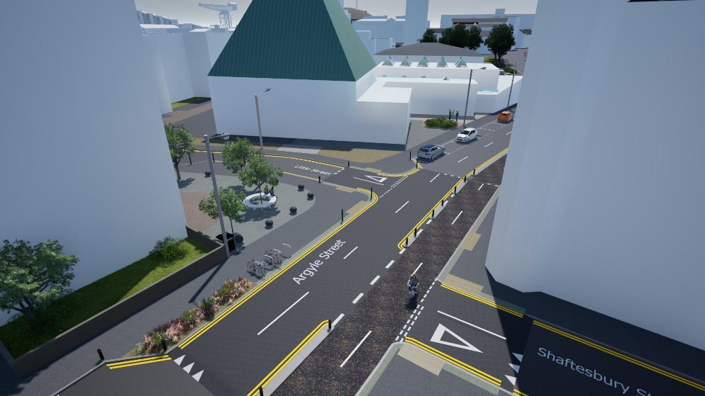
Argyle Street/Shaftesbury Street
A new two-way cycle track to the east and west of Anderston Station would join the almost-complete Avenues route on Argyle Street to existing protected infrastructure on Elderslie Street, creating a continuous active travel link between the city centre and the West End.


The proposals aim to tackle the barriers created by the M8, North Street and surrounding slip roads, which currently make the area unattractive to travel through for people who walk, wheel and cycle.
Cllr Angus Millar, city convener for Transport and Climate, said: “Major roads and motorway infrastructure have long made the area around Anderston Station unpleasant and difficult to navigate.
“These proposals would create a safer, greener and more accessible public space at Anderston Cross and create a more pleasant link between Anderston and the newly improved Argyle Street West Avenue in the city centre.
“The plans would also close a key gap in the active travel network, creating a more joined-up pedestrian and cycle link from the city centre to the West End through the area around Anderston Station and beneath the M8 to help people get around the city more conveniently and safely.


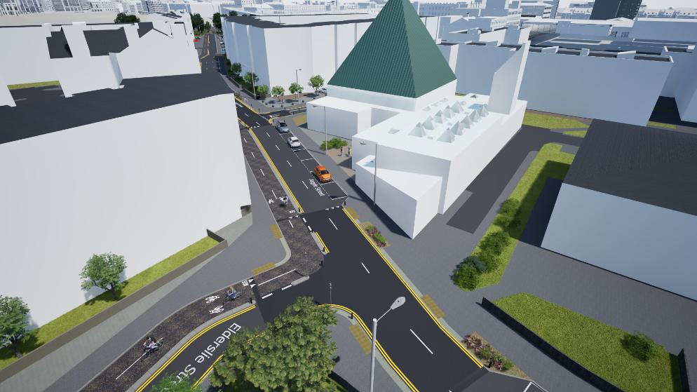
Argyle Street / Elderslie Street
“We want residents, businesses and everyone who travels through Anderston to look at the proposals and tell us what would make the biggest difference to the area.”
An online survey is now open and will run until Sunday 22 November 2026. Feedback will help shape the community features and the next stage of the designs.
A public drop-in event will also be held on Wednesday 21 October, from 3.30pm until 7pm, at The Pyramid at Anderston on 759 Argyle Street.
Design and consultation work for Connecting Anderston is being funded through Transport Scotland’s Active Travel Infrastructure Fund (ATIF).

Share this article:

Subscribe to our newsletter to not miss articles like this one:
 SUBSCRIBE